
Success message
Error message
Watershed Glossary & Resources
Learn the language of watersheds, conservation, native plants, stormwater, and stream protection. Find trusted resources from local, state, and national organizations.
Whether you're exploring native plants, reducing flooding, improving wildlife habitat, or learning about local streams, this page explains common terms and links to reliable sources for more information.
_________________________________________________________________________________________________________________________________
_________________________________________________________________________________________________________________________________
_________________________________________________________________________________________________________________________________
Looking for a term? The glossary is arranged alphabetically to help you quickly find common watershed, conservation, and environmental terms used throughout this website.
An underground layer of rock or soil that stores and supplies groundwater.
A practical method or structure used to reduce flooding, erosion, pollution, or other environmental impacts.
See Riparian Buffer.
A historic mill village along Paunacussing Creek known for its preserved 18th- and 19th-century architecture and listed on the National Register of Historic Places.
The ability of people, communities, and natural systems to prepare for, adapt to, and recover from changing weather and climate conditions.
The responsible protection and management of natural resources.
A voluntary legal agreement that permanently protects land from development while allowing private ownership.
Plants grown to protect and improve soil, reduce erosion, and help absorb stormwater.
A pipe or tunnel that carries water beneath a road, driveway, or trail.
A major river forming Pennsylvania's eastern border and the waterway into which Paunacussing Creek and Aquetong Creek flow.
An area where treated wastewater is slowly distributed through underground drip irrigation.
A community of living organisms interacting with one another and their environment.
The gradual wearing away of soil by water, wind, or human activity.
The low-lying land beside a stream or river that naturally floods during periods of high water.
The central portion of a floodplain where floodwaters flow most rapidly.
Natural or engineered features that capture, filter, and absorb stormwater close to where it falls.
Water stored beneath the earth's surface in soil and rock.
See Recharge.
The natural environment where plants and animals find food, water, shelter, and places to reproduce.
The study of water and its movement through rainfall, streams, groundwater, and the water cycle.
The continuous movement of water between the atmosphere, land, rivers, and oceans through evaporation, precipitation, and runoff.
A surface, such as a roof, road, or parking lot, that prevents rainwater from soaking into the ground.
See Rainfall Infiltration.
A non-native plant or animal that spreads aggressively and harms native ecosystems.
The Indigenous people who originally lived throughout the Delaware River Valley, including the Paunacussing watershed.
A historic Delaware River village known for its lumber industry, canal commerce, and well-preserved historic character.
Small aquatic animals without backbones, such as mayflies and stoneflies, that are used to measure stream health.
An open area dominated by grasses and wildflowers that provides wildlife habitat and absorbs stormwater.
Plants that naturally occur in our region and provide food and habitat for local wildlife while requiring fewer resources to thrive.
Pollution carried by rainfall or snowmelt from many locations, such as roads, lawns, and parking lots.
Excess nitrogen and phosphorus entering waterways, often from fertilizers, pet waste, or failing septic systems.
A Bucks County tributary of the Delaware River flowing from Buckingham Township to Lumberville. Its name is believed to mean "where powder was given to us."
A surface that allows rainwater to soak through into the ground.
Pollution released from a single identifiable source, such as a discharge pipe or wastewater treatment plant.
An animal, such as a bee, butterfly, bird, or bat, that carries pollen between flowers.
Materials that contaminate air, water, or soil and harm people, wildlife, or the environment.
A container that collects rainwater from a roof for later outdoor use.
A shallow landscaped area that captures and absorbs stormwater runoff.
The process of rainwater soaking into the soil instead of flowing across the land.
The process of rainwater soaking into the ground to replenish underground aquifers.
The process of collecting and manufacturing used materials into new products.
Relating to or located along the banks of a stream, creek, river, or other waterway.
A strip of native trees, shrubs, grasses, and wildflowers growing beside a stream that filters runoff, reduces erosion, and improves water quality.
Rainwater or snowmelt that flows across the land instead of soaking into the ground.
Soil, sand, or other particles carried by water and deposited in streams and rivers.
An underground wastewater treatment system serving homes that are not connected to a public sewer.
An area where treated wastewater is sprayed onto land to irrigate vegetation.
The responsible care and protection of natural resources.
An inlet that collects stormwater runoff and typically discharges directly into nearby waterways.
Rain or melting snow that flows over land, roads, roofs, and other surfaces after a storm.
The gradual wearing away of stream banks caused by flowing water.
See Riparian Buffer.
Projects that improve stream health by stabilizing banks, restoring natural flow, improving habitat, and reducing erosion and flooding.
Using natural resources wisely so they remain healthy and available for future generations.
A smaller stream or creek that flows into a larger stream, river, or lake.
A shallow seasonal wetland that provides critical breeding habitat for amphibians and other wildlife.
A measure of how clean and healthy a stream, river, or other body of water is for people and wildlife.
The upper level of groundwater beneath the earth's surface.
The area of land where all rainfall and snowmelt drain to the same stream, river, lake, or other body of water.
An area where water covers or saturates the soil long enough to support water-loving plants and wildlife.
The food, water, shelter, and space animals need to survive and reproduce.
Find out whether a property is located in a mapped floodplain.

Explore parcels, aerial photography, and mapping.
Forecasts and flood alerts.

View real-time stream levels.

Interactive environmental maps.
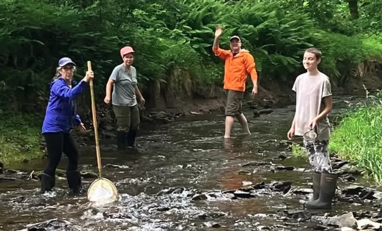
Every membership, donation, and volunteer effort helps protect clean water, healthy habitats, and our community for future generations.
Home About Learning Center News & Events Get Involved Contact
Volunteer-led 501(c)(3) nonprofit organization
Protecting and restoring the Paunacussing Watershed through stewardship, restoration, education, and community engagement.
Donations are tax deductible.